The Gaspé Peninsula: A world of oceans and mountains
The imposing Gaspé Peninsula, jutting out into the Atlantic, offers its inhabitants and the many visitors who flock to the area beautiful vistas of the sea and mountains. As big as Belgium, with just over 30,000 square kilometres, its population of more than 100,000 people is concentrated in waterside towns and villages, and the mountains of the interior have largely remained a wild and virgin territory that is much appreciated by outdoors enthusiasts.

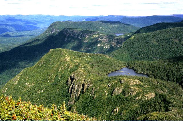
 (92 kb)The mountains at the heart of the Gaspé Peninsula are among the tallest in Quebec. Mount Jacques-Cartier, for example, reaches 1,268 m and is the highest summit in the southern part of the province. But these mountains are only a shadow of what they once were, as gradual erosion – particularly by glaciers during the most recent ice age – transformed the once towering peaks into undulating plateaus.
Mountains this worn down are also very old. The great natural barrier of the Chic-Choc mountain range was built about 450 million years ago in several long phases, spread out over tens of millions of years.

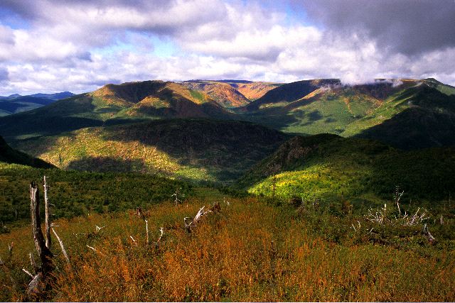
 (80 kb)The Gaspé is but the northeastern tip of the Appalachians – an extensive mountain chain that begins as far away as Alabama in the United States. Hikers who walk the length of the famous International Appalachian Trail are very proud of their accomplishment once they reach the end at Cap-Gaspé. But few of them realize that they have only seen half of the Appalachians, the next section beginning on the island province of Newfoundland in the Atlantic, and continuing to the other side of the ocean, into the highlands of Scotland and Norway...
The names of several mountains in the Gaspé and Saint-Lawrence Lowlands pay tribute to the contributions of geologists who explored the region.
Mount Bayfield (1,058 metres), Haute-Gaspésie. Named in 1844 by William E. Logan in honour of explorer and cartographer Henry Wolsey Bayfield (1795-1885).
Mount Ells (1,000 metres), Haute-Gaspésie. Named in honour of explorer and geologist R. Hugh W. Ells of the Geological Survey of Canada (1845-1911). Ells rediscovered the Miguasha site in 1879.
Mount Logan (1,150 metres), Saint-Lawrence Lowlands. Named in honour of geologist William Edmond Logan (1798-1875) who founded the Geological Survey of Canada in 1842.
McGerrigle Mountains, Haute-Gaspésie. The massif of the McGerrigle Mountains covers more than 100 square kilometres. Its highest summit is Mount Jacques-Cartier, which reaches 1,268 metres. The name of the massif celebrates the contributions of geologist Harold William McGerrigle (1904-1970) to the geology of the Gaspé. He worked for the Quebec government from 1937 to 1970.
Mount Richardson (1,184 metres), Haute-Gaspésie. Named in honour of explorer and geologist James Richardson (1810-1883) of the Geological Survey of Canada.

 (92 kb)The mountains at the heart of the Gaspé Peninsula are among the tallest in Quebec. Mount Jacques-Cartier, for example, reaches 1,268 m and is the highest summit in the southern part of the province. But these mountains are only a shadow of what they once were, as gradual erosion – particularly by glaciers during the most recent ice age – transformed the once towering peaks into undulating plateaus.
Mountains this worn down are also very old. The great natural barrier of the Chic-Choc mountain range was built about 450 million years ago in several long phases, spread out over tens of millions of years.

 (80 kb)The Gaspé is but the northeastern tip of the Appalachians – an extensive mountain chain that begins as far away as Alabama in the United States. Hikers who walk the length of the famous International Appalachian Trail are very proud of their accomplishment once they reach the end at Cap-Gaspé. But few of them realize that they have only seen half of the Appalachians, the next section beginning on the island province of Newfoundland in the Atlantic, and continuing to the other side of the ocean, into the highlands of Scotland and Norway...
 The names of several mountains in the Gaspé and Saint-Lawrence Lowlands pay tribute to the contributions of geologists who explored the region.
Mount Bayfield (1,058 metres), Haute-Gaspésie. Named in 1844 by William E. Logan in honour of explorer and cartographer Henry Wolsey Bayfield (1795-1885).
Mount Ells (1,000 metres), Haute-Gaspésie. Named in honour of explorer and geologist R. Hugh W. Ells of the Geological Survey of Canada (1845-1911). Ells rediscovered the Miguasha site in 1879.
Mount Logan (1,150 metres), Saint-Lawrence Lowlands. Named in honour of geologist William Edmond Logan (1798-1875) who founded the Geological Survey of Canada in 1842.
McGerrigle Mountains, Haute-Gaspésie. The massif of the McGerrigle Mountains covers more than 100 square kilometres. Its highest summit is Mount Jacques-Cartier, which reaches 1,268 metres. The name of the massif celebrates the contributions of geologist Harold William McGerrigle (1904-1970) to the geology of the Gaspé. He worked for the Quebec government from 1937 to 1970.
Mount Richardson (1,184 metres), Haute-Gaspésie. Named in honour of explorer and geologist James Richardson (1810-1883) of the Geological Survey of Canada.
Site map | Feedback | Links | Sources | Credits
The Gaspé Peninsula: A world of oceans and mountains
<< Miguasha: A story written in stone | The closing of an ocean >>


