Le Parc national de Miguasha
The Province of Quebec has 22 national parks that aim to preserve and develop representative territories, or sites of an exceptional character.
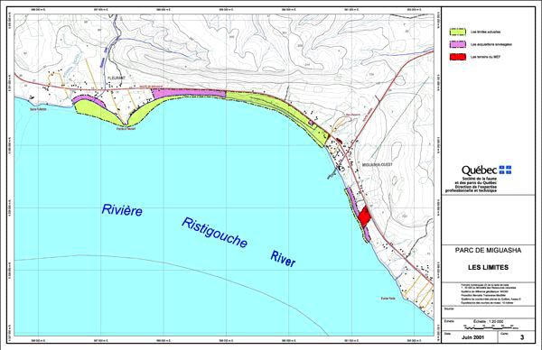
 (40 kb) With a surface area of only 0.8 km2, the Parc national de Miguasha is the smallest of these parks. Located at the western extremity of the Baie des Chaleurs on the Gaspé Peninsula, it consists of a straight strip of land that follows a fossil-rich cliff.
In January of 1985, the Miguasha fossil site officially became part of the Parcs Québec network.
 (60 kb)The development of the site began much earlier, in 1976 to be exact, when a team from the Université du Québec à Rimouski began initial preparations for the interpretation centre, which opened its doors two years later in 1978. It now houses a Natural History Museum that includes laboratory facilities for the preparation of specimens and collection rooms to store and protect them. Permanent display rooms introduce visitors to paleontology while presenting the amazing fossil wealth of the Escuminac Formation. About 26,000 visitors come to Miguasha every year, and they leave with a new respect for fossils as witnesses of our distant past.

 (44 kb)The Province of Quebec recognizes that the fossil-rich Miguasha cliff represents an important part of our heritage and must be protected. Quebec’s law concerning parks stipulates that visitors are forbidden to collect rock samples within park limits, and the Escuminac rock formation is protected by ministerial decrees from the Government of Quebec that exclude it from claim staking and mineral exploration. Visitors are also forbidden to go fossil hunting, split open rocks, or remove rocks from the beach or cliff.

 (40 kb) With a surface area of only 0.8 km2, the Parc national de Miguasha is the smallest of these parks. Located at the western extremity of the Baie des Chaleurs on the Gaspé Peninsula, it consists of a straight strip of land that follows a fossil-rich cliff.
In January of 1985, the Miguasha fossil site officially became part of the Parcs Québec network.

 (60 kb)The development of the site began much earlier, in 1976 to be exact, when a team from the Université du Québec à Rimouski began initial preparations for the interpretation centre, which opened its doors two years later in 1978. It now houses a Natural History Museum that includes laboratory facilities for the preparation of specimens and collection rooms to store and protect them. Permanent display rooms introduce visitors to paleontology while presenting the amazing fossil wealth of the Escuminac Formation. About 26,000 visitors come to Miguasha every year, and they leave with a new respect for fossils as witnesses of our distant past.
 (44 kb)The Province of Quebec recognizes that the fossil-rich Miguasha cliff represents an important part of our heritage and must be protected. Quebec’s law concerning parks stipulates that visitors are forbidden to collect rock samples within park limits, and the Escuminac rock formation is protected by ministerial decrees from the Government of Quebec that exclude it from claim staking and mineral exploration. Visitors are also forbidden to go fossil hunting, split open rocks, or remove rocks from the beach or cliff.
 Site map | Feedback | Links | Sources | Credits
Le Parc national de Miguasha
<< The 1991 International Symposium | Protecting a unique heritage >>

Title: Park territory
Author: Ron Garnett
Sources: Municipalité de Nouvelle
Year: 2003
Description:
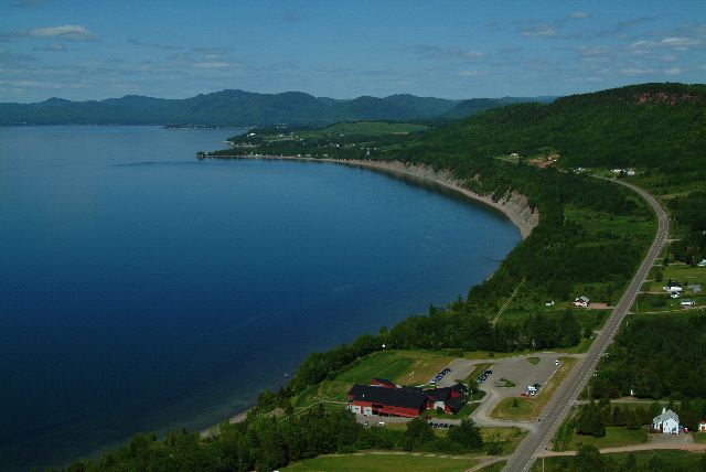
The Miguasha cliff with the Natural History Museum in the foreground.


